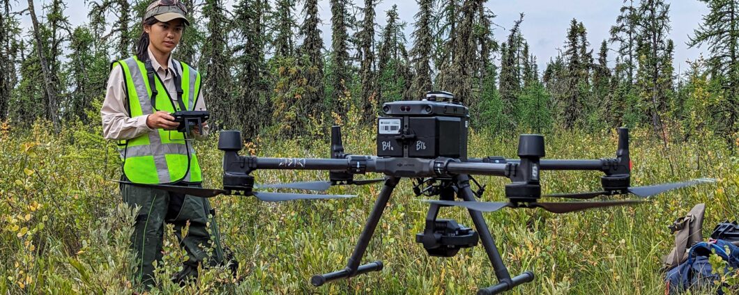
The remote sensing team’s strategic priorities are restoration assessment and restoration monitoring.
Greg McDermid, Remote Sensing Team Lead
Greg is a geospatial scientist whose research activities revolve around the application of remote sensing and other geospatial technologies to environmental monitoring and ecology. He is involved in a wide variety of interdisciplinary research collaborations in the fields of wildlife ecology, biodiversity assessment, ecological monitoring, plant-phenology assessment, and vegetation mapping. He’s interested in a broad range of remote sensing and other GIScience pursuits, including UAVs, cloud computing, environmental modelling, and data fusion/integration.
Irina Terentieva, Postdoctoral Fellow
Irina is a postdoctoral fellow who joined BERA in Spring 2022. Her past work involved organizing and carrying out field investigations of peatlands, floodplains, lakes, and arctic areas of Western Siberia with a focus on large-scale greenhouse gas emission estimates and remote sensing. Her current research applies neural networks for object detection of seedlings using drone imagery. In her spare time, Irina enjoys traveling in remote locations and experiencing local cultures. Irina has also participated in speleological expeditions to the deepest caves spending many days underground!
Colette Shellian, MSc Student
Colette is a Master’s student with interests in forest ecology and using remote sensing techniques to understand forest regeneration in fragmented landscapes. Her current research investigates factors that influence seedling growth on seismic lines. In her spare time, Colette loves spending time in the mountains- whether it be hiking, paddle boarding, kayaking or skiing.
Nicole Byford, MSc Student
Nicole is a Master’s student joining BERA’s remote sensing team under the supervision of Greg McDermid. Her research is focused on using aerial remote sensing technologies to assess vegetation recovery along seismic lines in northern Alberta. In her spare time, Nicole enjoys hiking, cross-country skiing, and reading.
Xue Yan Chan, MSc Student
Xue Yan is a Master’s student joining BERA’s remote sensing team in Fall 2022. Xue Yan is a drone operator and her research is focused on linking plant traits to drone-based remote sensing datasets. She’s interested in using machine learning methods for 2-D and 3-D image analysis.
Tanya Yeomans, MSc Student
Tanya comes from a multidisciplinary background and is looking forward to working with spectral time series data in Google Earth Engine to track vegetation recovery on boreal disturbances.
Marlis Hegels, MSc Student
Marlis is a Masters student from Ludwig-Maximilians-University in Munich doing research on solar irradiance on seismic lines. She completed her bachelor degree in geography with a minor in computer science. Marlis has experience in geospatial programming. In her free time she enjoys outdoor sports like skiing, mountain biking and hiking.
Niklas Heiss, MSc Student
Niklas Heiss is a German master student at LMU Munich and currently working on his thesis within the BERA project. He works on the topic of how to use Radar interferometry as a technique for mapping surface deformations around peatland linear disturbances. During his Bachelor degree in geography and his minor physics (also at LMU) he gained knowledge about remote sensing, GIS, AI, hydrology and optics. In his recreational time he is skiing, hiking, biking or playing saxophone in his band.
Patrick Klotz, MSc Student
Patrick graduated with a Bachelors Degree in Geography from the University of Augsburg and is currently enrolled in a Masters program at the Ludwig-Maximilian-University in Munich, studying environmental Monitoring and Management. He is working with BERA through the Mitacs Globalink Research Award under the supervision of Greg McDermid and Ralf Ludwig in the remote sensing team. His research focus is on mapping human and animal use on seismic lines from high resolution stereo-imagery through machine learning techniques.