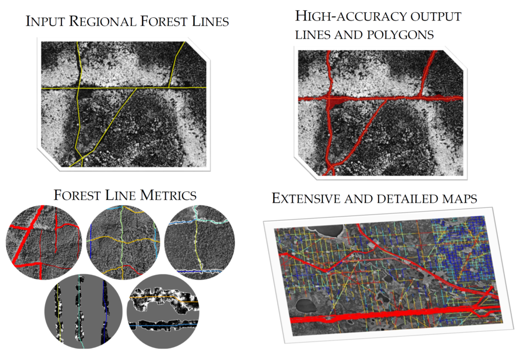
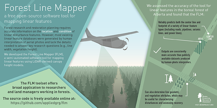
The Forest Line Mapper (FLM) is the first of a series of geospatial software tools designed to assist researchers and land managers working in and around linear-feature disturbances in forests.
Most linear-feature databases work fine for cartographic purposes but are not up to the demands of detailed research and restoration planning. The FLM transforms existing linear-feature layers into accurate, attribute-rich inventories that rival – and in many cases exceed – what could be created by hand digitizing.
Downloads and documentation for the free, open-source FLM can be found here.
A peer-reviewed journal article describing the workflows employed by FLM, plus an accuracy assessment, can be found here.