Silvicultural Treatments Hasten Seedling Growth in Boreal Treed Fens
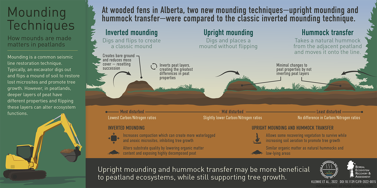
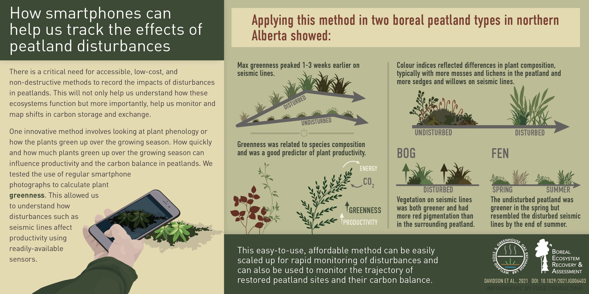
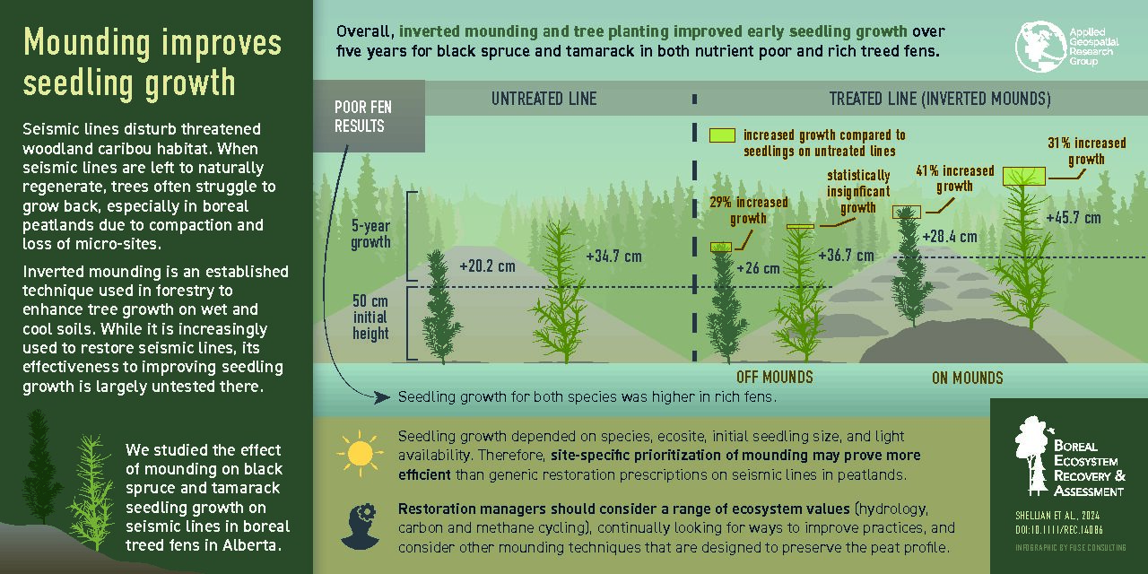
Seismic lines in western Canada’s boreal region are linear disturbances that affect the habitat of threatened woodland caribou (Rangifer tarandus caribou). To hasten the return of forest cover and ultimately to restore caribou habitat, restoration managers use silviculture treatments in wet areas that involve the mechanical mounding of seismic lines to create artificial hummocks. Tree planting then takes place on top of these hummocks. However, the effectiveness of this silviculture technique for restoring seismic lines in peatlands is largely untested.
BERA researchers sampled incremental height growth of coniferous seedlings at 41 seismic line plots in poor and rich treed fens in northeast Alberta, Canada. They compared lines that had been treated with inverted mounding (a type of mechanical mounding) and subsequent tree planting, to nearby lines that were left untreated for natural recovery. Overall, they found that mounding and tree planting improved seedling growth compared to seismic lines regenerating naturally. However, growth responses were found to vary by species, ecosite, initial seedling size, and light availability.
For the full article click here.
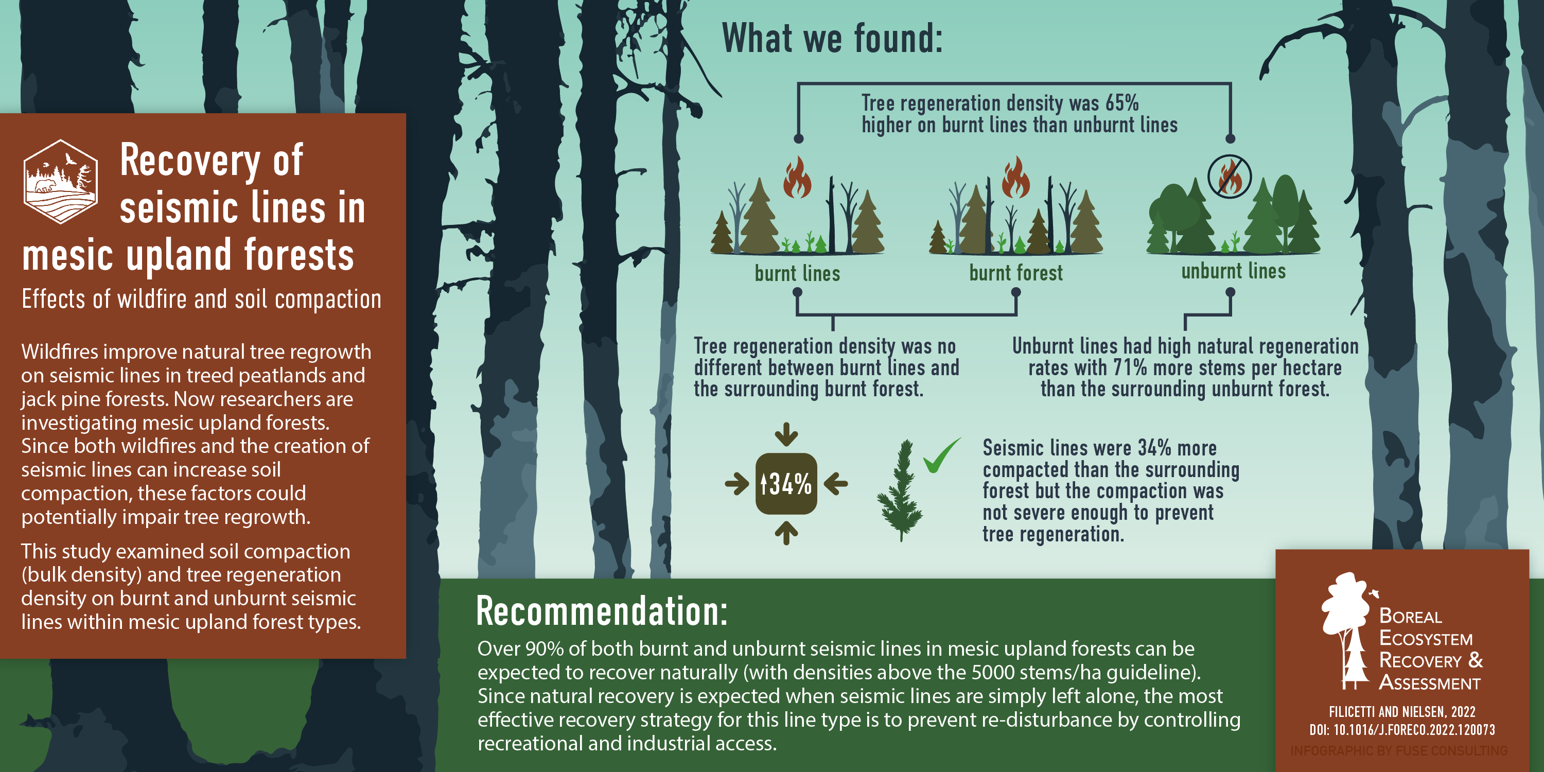
Most Lines in Mesic Uplands Can be Left for Natural
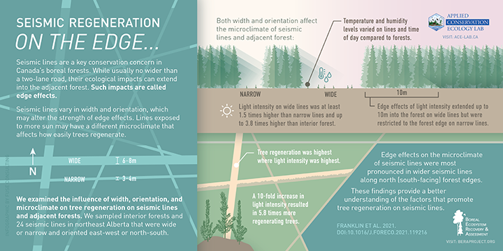
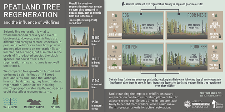
Alberta’s legacy seismic lines need restoration actions, but the sheer volume of lines on the landscape is daunting. Part of the challenge involves distinguishing lines that require active treatments from those that can be left for natural. Wildfires are the dominant disturbance agent in the boreal forest and can be an effective promoter of natural restoration in the right situations.
BERA researchers have previously published on the topic of wildfire effects on natural tree growth in jack pine forests and treed peatlands. Here, they tackle mesic upland forests. The work shows that tree regeneration density is 65% higher on burnt lines than unburnt lines in this ecosite type, and that fires can effectively “erase” lines from the surrounding matrix. However, even unburnt lines in the study had high rates of natural regeneration. This suggests that most lines in mesic upland forests can be effectively left for natural. These findings could help prioritize limited restoration dollars to more challenging ecosite types.
For the full article click here.